 Tweet
Tweet
originally posted by waterman....
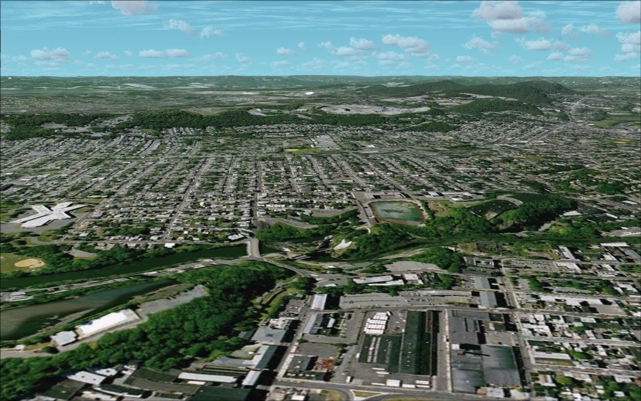
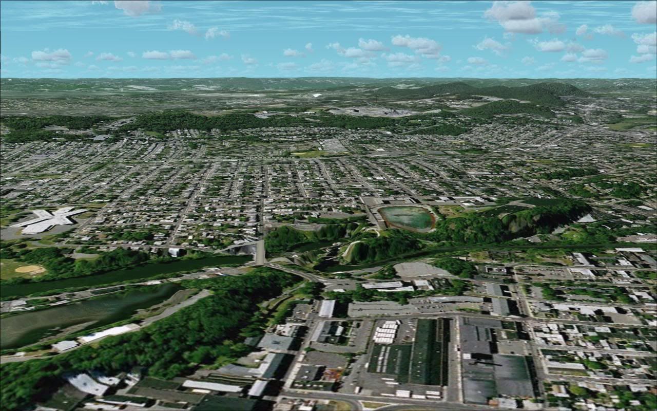
After the helicopter flight in Hawaii on Friday I mentioned terrain meshes and piqued some peoples interests. I think the best way to describe terrain mesh is by pictures. So attached are 3 images from the same location in New Jersey (images were taken with a photo scenery)
One at the FSX default for the US of 38 Meters,
one at 10 M,
and one at 5 M.
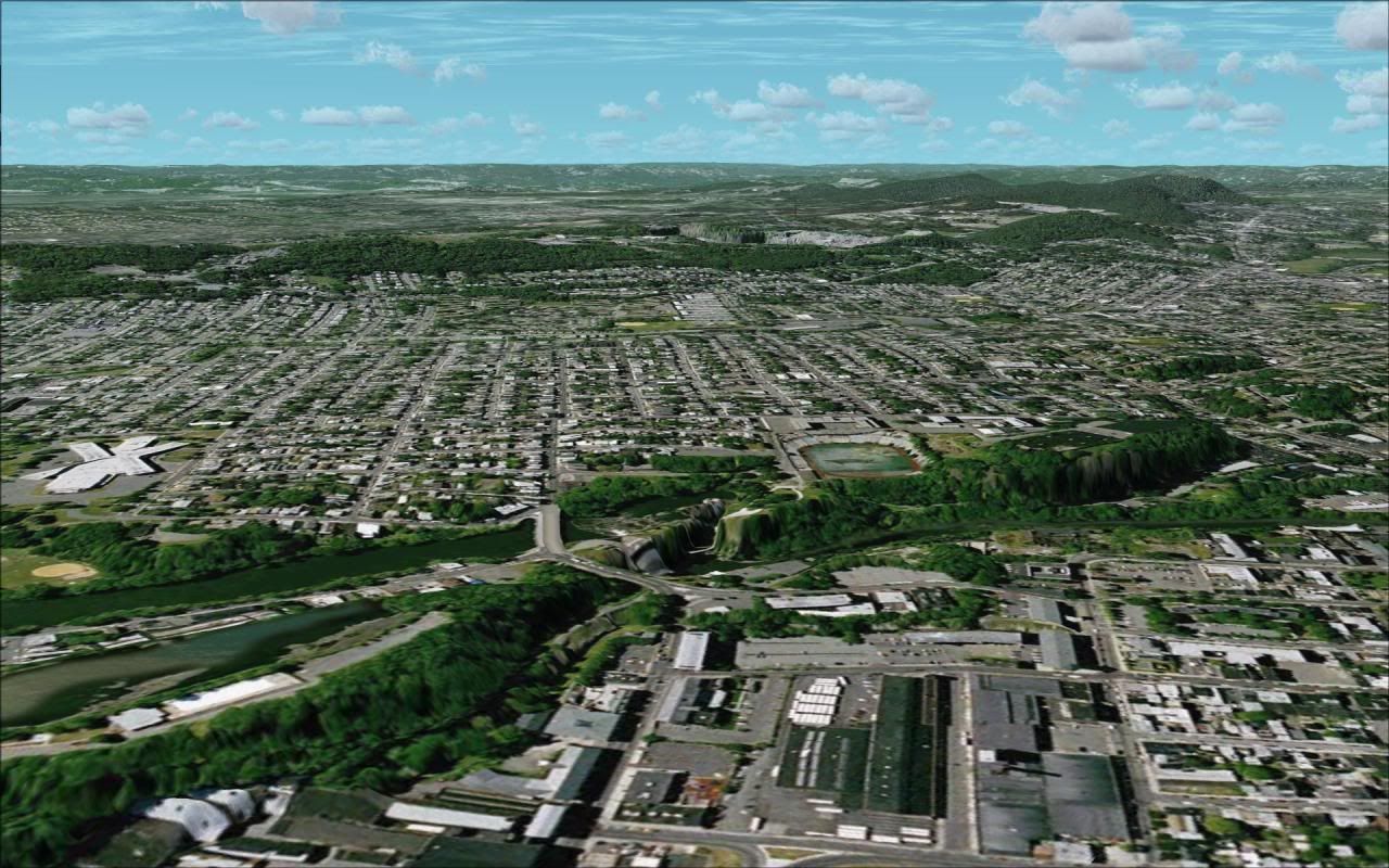
So as you can see the difference is in elevations of the land itself. Think of it this way.. the 38M mesh has data points 38 Meters apart. This means a general smoothing. The larger the number even more smoothing. Some of the FSX default world is up to 612M! But if that is a superflat part of the world, with no geographic features, that’s great. It saves disk space. But in some areas you want the world to look more realistic. So the 10M mesh has datapoints 10M apart. And the same for 5M.
There are Payware addons, such as FS Genesis, that have higher resolution meshes, and there is also a lot for free. Both Flightsim.com and Simviation have lots of it. You can also use http://www.freewarescenery.com/ to find mesh for the part of the world you like. I’ve uploaded most of the continental US in 10M to Hawg’s FTP, along with 10M Hawaii, 5M New Jersey, and 5M Mount St. Helens. Simviation limits you to 2 transfers at a time at 39kbps without paying for access. So much easier to grab it for our group if you want it. Let me know if you have questions.
After the helicopter flight in Hawaii on Friday I mentioned terrain meshes and piqued some peoples interests. I think the best way to describe terrain mesh is by pictures. So attached are 3 images from the same location in New Jersey (images were taken with a photo scenery)
One at the FSX default for the US of 38 Meters,
one at 10 M,
and one at 5 M.
So as you can see the difference is in elevations of the land itself. Think of it this way.. the 38M mesh has data points 38 Meters apart. This means a general smoothing. The larger the number even more smoothing. Some of the FSX default world is up to 612M! But if that is a superflat part of the world, with no geographic features, that’s great. It saves disk space. But in some areas you want the world to look more realistic. So the 10M mesh has datapoints 10M apart. And the same for 5M.
There are Payware addons, such as FS Genesis, that have higher resolution meshes, and there is also a lot for free. Both Flightsim.com and Simviation have lots of it. You can also use http://www.freewarescenery.com/ to find mesh for the part of the world you like. I’ve uploaded most of the continental US in 10M to Hawg’s FTP, along with 10M Hawaii, 5M New Jersey, and 5M Mount St. Helens. Simviation limits you to 2 transfers at a time at 39kbps without paying for access. So much easier to grab it for our group if you want it. Let me know if you have questions.


Comment